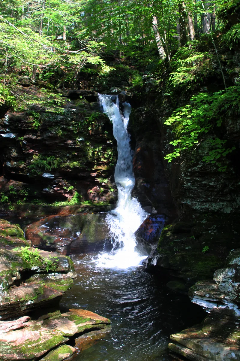
Ricketts Glen State Park is a large Pennsylvania state park in the hills of the northeast, spread across Luzerne, Sullivan and Columbia counties. It is best known for the Glens Natural Area, a National Natural Landmark where two branches of Kitchen Creek cut through deep gorges in a run of waterfalls. People come to walk the Falls Trail past those cascades, and the park counts 22 named waterfalls in all.
On the trail you hear water the whole way, crashing over ledges above you or trickling along pebbly creeks beside you. The falls range from 11 feet up to Ganoga Falls at 94 feet, the tallest in the park, and the old trees overhead are the kind of giants that were already standing long before the park existed. If you want less of a climb, the shorter loop still passes most of the waterfalls, and the Evergreen Trail walks you down to Adams Falls on easy ground.
There is a gentler side too. Lake Jean is a 245-acre lake open only to electric motors, so it suits kayaks, canoes and paddleboards, and there is a sandy beach for swimming. The park grew out of land once owned by Colonel Robert Bruce Ricketts, who built trails to the falls and named many of them for American Indian tribes and for his friends and family.
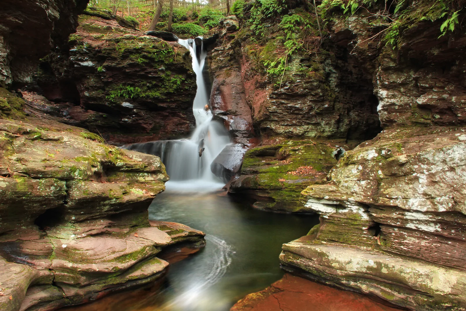
At 94 feet, Ganoga Falls is the tallest of the park's 22 named waterfalls. It sits in Ganoga Glen along the Falls Trail, not far from the Lake Rose parking lot.
Starts
Falls Trail in Ganoga Glen, not far from the Lake Rose parking lot
When
Hours not listed. Check the official site.
Nicholas A. Tonelli from Northeast Pennsylvania, USA · Source · CC BY 2.0
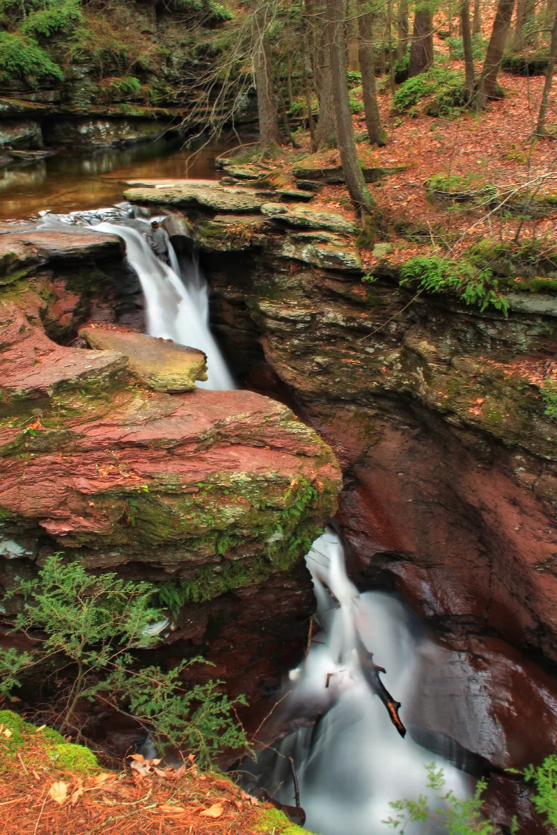
Adams Falls is the park's 22nd named waterfall and the easy one to reach, only a few hundred feet from the Evergreen Parking Lot off PA 118. It sits apart from the main Falls Trail loop, so it works as a quick stop even when you are not up for the full hike.
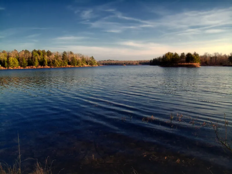
Lake Jean covers 245 acres and is popular for boating, with rowboats, electric motorboats, kayaks, canoes, sailboats and paddleboards. Only electric motors are allowed, at slow, no-wake speed. There are two boat launches and dry mooring, and boat rentals are available. Electric motors only, at slow, no-wake speed.
Distance
245 acres
When
The boat rental concession is usually open daily in summer, 10:00 A.M. to 6:00 P.M., weather permitting.
A 600-foot beach on Lake Jean with a food and refreshment concession, boat rental and picnic facilities close by, set aside for swimming in a designated area. Swimming is allowed only inside the designated area, and smoking is prohibited on the beach and in the swimming area.
Starts
Lake Jean beach area
Distance
600-foot beach
When
The beach is open from late May to mid-September, 8:00 A.M. until sunset.
Lake Jean holds warmwater panfish and game fish, and the park permits ice fishing on the lake's natural ice in winter. An accessible fishing pier sits just off the Western boat launch. Ice thickness is not monitored; at least four inches of solid ice is recommended for one person and seven for a small group.
A short, easy out-and-back walk along the southern edge of Lake Jean, running from the eastern boat launch to the campground's Big Loop. It gives campers a flat way to reach the beach and day use areas.
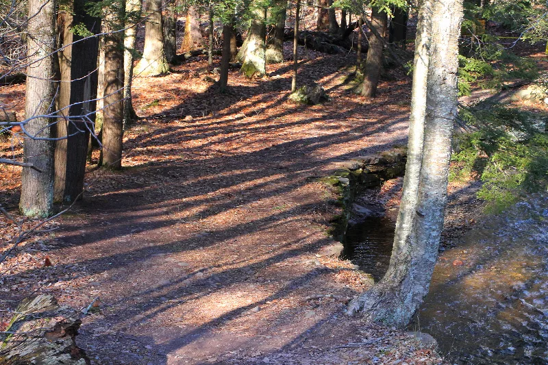
The Falls Trail follows two branches of Kitchen Creek through the Glens Natural Area, a series of 21 wild, free-flowing waterfalls cascading through rock-strewn cliffs. The full loop is 7.2 miles, and the terrain is rocky, descends steeply and can be slippery. Expect rock steps going down and up again, with the sound of water along the way. Hikers should be in good physical condition and wear sturdy boots because of wet, slippery conditions and steep sections.
Starts
Lake Rose Trailhead or Beach Lot #2
Time
Allow most of a day for the full 7.2-mile loop, with stops at the falls.
Distance
7.2-mile full loop, or a 3.2-mile loop past most of the falls
When
The Falls Trail is closed in winter except for properly equipped ice climbers and hikers.
Local tipPark at Lake Rose Trailhead, which puts you at the top of the waterfalls and trims roughly 2.5 miles off the walk, and arrive early because the lot fills quickly.
The Glens Natural Area is where Kitchen Creek's two branches cut through deep gorges and join at Waters Meet, then run on through a glen of giant pines, hemlocks and oaks. Many of the trees are more than 300 years old, and some tower to 100 feet. It became a registered National Natural Landmark in 1969. Fishing is prohibited in the Glens Natural Area.
A short loop rated easiest that starts at the Evergreen Parking area and descends to Adams Falls, the park's 22nd named waterfall. Continuing down the path you reach a self-guided nature tour with kid-friendly signs.
The Highland Trail links the two glens into a loop and crosses the Midway Crevasse, formed by Pocono sandstone conglomerates deposited by continental glaciers hundreds of feet thick, and an excellent area for geological study.
Distance
1.2 miles
When
Hours not listed. Check the official site.
Local tipTaking this trail with the Glen Leigh and Ganoga Glen sides makes the 3.2-mile loop past most of the waterfalls.
This easy loop follows the fire tower access road up Red Rock Mountain, the highest point in the park, then continues rocky through mountain laurel and berry bushes before looping back. The woods here are red oak and mixed hardwood, a different feel from the glens. The fire tower is closed to the public.
A steep trail once used by a bulldozer to reach the top of the mountain, rated most difficult. It is also used by snowmobilers, and a path marked by scouts leads to the Valley View Vista at the top of the ridge.
When winter freezes the falls, climbers head to Ganoga Falls, where the Left Wall runs about 100 feet at WI3 and the Right Wall offers several vertical lines in the 30 to 40 foot range at WI3+/4. Minimal equipment is ice crampons, ice axes and rope. Climbers must sign in and out at the park office; from the Rt. 118 area, call the office to sign in.
In winter the park's other trails are open for cross-country skiing and snowshoeing. Several of the gentler routes, like Beach Trail, Bear Walk Trail and Laurel View Trail, are recommended for both.
When
The park is open every day of the year, including winter.
An out-and-back route just beyond the old Lake Leigh dam, running through groves of cherry trees and past remnants of old logging railroads. A short connector, Little Cherry Run Trail, follows Cherry Run through unusual rock formations.
Starts
Beach Lot #2
Distance
4.6 miles out and back
When
Hours not listed. Check the official site.
Falls Trailhiking
The Falls Trail follows two branches of Kitchen Creek through the Glens Natural Area, a series of 21 wild, free-flowing waterfalls cascading through rock-strewn cliffs. The full loop is 7.2 miles, and the terrain is rocky, descends steeply and can be slippery. Expect rock steps going down and up again, with the sound of water along the way. Hikers should be in good physical condition and wear sturdy boots because of wet, slippery conditions and steep sections.
Starts
Lake Rose Trailhead or Beach Lot #2
Time
Allow most of a day for the full 7.2-mile loop, with stops at the falls.
Distance
7.2-mile full loop, or a 3.2-mile loop past most of the falls
When
The Falls Trail is closed in winter except for properly equipped ice climbers and hikers.
Local tipPark at Lake Rose Trailhead, which puts you at the top of the waterfalls and trims roughly 2.5 miles off the walk, and arrive early because the lot fills quickly.
The Glens Natural Area is where Kitchen Creek's two branches cut through deep gorges and join at Waters Meet, then run on through a glen of giant pines, hemlocks and oaks. Many of the trees are more than 300 years old, and some tower to 100 feet. It became a registered National Natural Landmark in 1969. Fishing is prohibited in the Glens Natural Area.
A short loop rated easiest that starts at the Evergreen Parking area and descends to Adams Falls, the park's 22nd named waterfall. Continuing down the path you reach a self-guided nature tour with kid-friendly signs.
The Highland Trail links the two glens into a loop and crosses the Midway Crevasse, formed by Pocono sandstone conglomerates deposited by continental glaciers hundreds of feet thick, and an excellent area for geological study.
Distance
1.2 miles
When
Hours not listed. Check the official site.
Local tipTaking this trail with the Glen Leigh and Ganoga Glen sides makes the 3.2-mile loop past most of the waterfalls.
This easy loop follows the fire tower access road up Red Rock Mountain, the highest point in the park, then continues rocky through mountain laurel and berry bushes before looping back. The woods here are red oak and mixed hardwood, a different feel from the glens. The fire tower is closed to the public.
A steep trail once used by a bulldozer to reach the top of the mountain, rated most difficult. It is also used by snowmobilers, and a path marked by scouts leads to the Valley View Vista at the top of the ridge.
When winter freezes the falls, climbers head to Ganoga Falls, where the Left Wall runs about 100 feet at WI3 and the Right Wall offers several vertical lines in the 30 to 40 foot range at WI3+/4. Minimal equipment is ice crampons, ice axes and rope. Climbers must sign in and out at the park office; from the Rt. 118 area, call the office to sign in.
In winter the park's other trails are open for cross-country skiing and snowshoeing. Several of the gentler routes, like Beach Trail, Bear Walk Trail and Laurel View Trail, are recommended for both.
When
The park is open every day of the year, including winter.
An out-and-back route just beyond the old Lake Leigh dam, running through groves of cherry trees and past remnants of old logging railroads. A short connector, Little Cherry Run Trail, follows Cherry Run through unusual rock formations.