Take the quiz
You need this.

Pennsylvania · State Park

Hickory Run State Park

Facts checked against official sources Published · Last updated · Checked
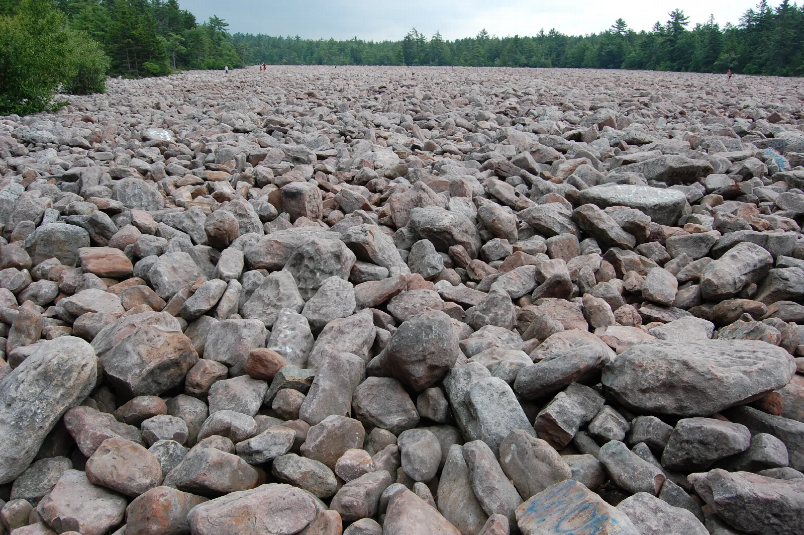
The boulder field at Hickory Run State Park in Pennsylvania, PA, USA. Note the people in the distance for scale.
Mtruch · Source · CC BY-SA 3.0
Drive57 minfrom Scranton, PA, the nearest city · about 41 miles
TripDay or overnight
VibeWaterWoodsSmall town
Things to do12See them all

Water. Woods. Small town.

Hickory Run State Park is a 15,990-acre park in the western foothills of the Pocono Mountains in Carbon County, Pennsylvania. People come for the Boulder Field, a National Natural Landmark, for a 25-foot waterfall, and for more than 40 miles of trails that wind through forest and along trout streams.

The Boulder Field is the signature sight: a 16.5-acre spread of boulders left from the ice ages, some under 3 feet long and some more than 30. You can reach it by driving a one-way dirt loop or by hiking in 3.5 miles on the Boulder Field Trail. Elsewhere, Hawk Falls drops 25 feet at the end of a short trail through rhododendron, and the Shades of Death Trail follows a tea-colored creek past dense rhododendron and the remains of old logging dams. Sand Spring Lake has the park's one designated sand beach for swimming, and anglers work Mud Run, Hickory Run and Sand Spring Run for trout.

The park has a long human story too. Lumber mills lined the streams in the 1800s, a stagecoach road crossed the area, and the Civilian Conservation Corps later built much of what you walk on today. The Manor House and the chapel are all that remain of the old town of Hickory Run. Winter brings its own season of cross-country skiing, snowmobiling and skating on the lake's natural ice.

Pick two. Go.

Things to do

12 ways to spend the day. Checked Nov 17, 2026.

Water first · 4
waterfall

Hawk Falls

A natural 25-foot waterfall at the end of a short trail that wanders through a tunnel of rhododendron. The trail runs 0.6 mile each way, and the climb back out is harder than the walk down. Swimming at the falls is not allowed. Swimming is prohibited at Hawk Falls.

Starts
Small lot off PA 534, just east of the turnpike overpass
Distance
0.6 mile each way
When
Hours not listed. Check the official site.

Local tipThe small lot fills by mid-morning on summer and fall weekends, so go early.
beach Open

Sand Spring Lake beach

The park's one designated swimming area, a sand beach on Sand Spring Lake. There is a walkway to the water, parking and restrooms nearby, and a snack bar with sandwiches, drinks, ice cream and snacks. Swimming happens only here, not at the waterfalls. Swim at your own risk and follow the posted rules.

When
The beach is open for swimming from late May to mid-September, 8:00 A.M. to sunset.
fishing Open

Mud Run

A wild trout stream canyon that makes a quieter, more rugged alternative to the busier trails. It is reached by following the trail downstream from Hawk Falls. The stream is stocked with trout and also holds native trout.

Starts
Hawk Falls Trail or Orchard Trail
When
Mud Run is delayed harvest, artificial lures only, and open to harvest June 15 to Labor Day.
fishing

Trout fishing on Hickory Run and Sand Spring Run

Sand Spring Run runs beside the Shades of Death Trail and is stocked with trout in the spring, with four dams along it. Hickory Run is stocked from Hickory Run Lake down to Saylorsville Dam and also has native trout. From Saylorsville Dam to the Lehigh River, Hickory Run is catch and release only, artificial lures and barbless hooks.

Starts
Hickory Run access from the back road between Saylorsville Dam and the chapel, or from Boulder Field Road
When
Hours not listed. Check the official site.
Also here · 8
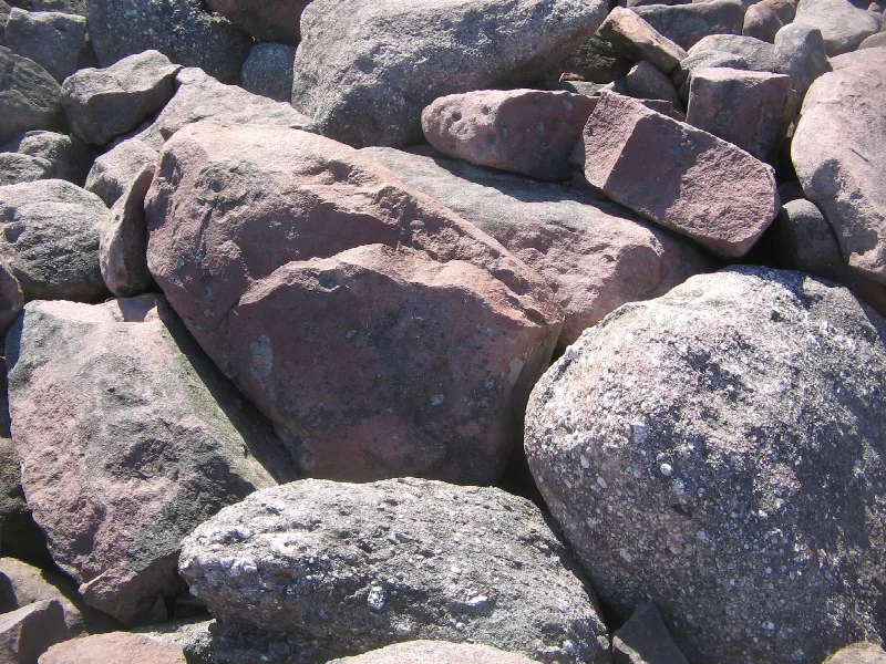
Detail of boulders in the Boulder Field (a National Natural Landmark) in Hickory Run State Park in Carbon County, Pennsylvania, USA
Ruhrfisch (talk) · Source · CC BY-SA 4.0
hiking

Boulder Field

A 16.5-acre field of ice-age boulders, roughly 1,800 feet by 400 feet, that looks like the surface of another planet. Some boulders are under 3 feet long and others top 30, and you walk on top of them, not between them. There is no shade and no water on the field, so bring plenty.

Starts
Boulder Field parking lot via the one-way Boulder Field Road, or the Boulder Field Trail from PA 534
Distance
3.5 miles one-way by trail
When
Hours not listed. Check the official site.

Local tipFooting is the challenge: the gaps between boulders are deep and unpredictable, so sturdy boots matter, and rain makes the rocks slippery.

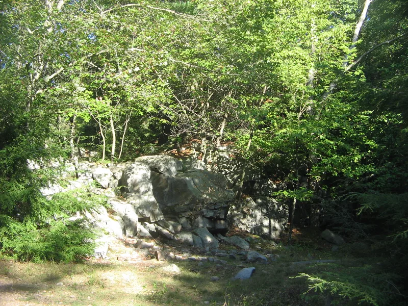
Rock formation along Shades of Death Trail along Sand Spring Run in Hickory Run State Park in Carbon County, Pennsylvania, USA
Ruhrfisch (talk) · Source · CC BY-SA 4.0
hiking

Shades of Death Trail

One of the most picturesque trails in the park, following Sand Spring Run through dense rhododendron past the remains of logging mills and dams from the early 1800s. It is only a mile each way but rocky and rooty, and the park rates it most difficult.

Starts
Visitor Center trailhead
Distance
1 mile one-way
When
Hours not listed. Check the official site.

Local tipRoots are slick when wet, so trekking poles help.

scenic

Fireline Trail and Lehigh Gorge Overlook

Originally built as an access road for firefighting equipment, this scenic trail leads to an overlook above the Lehigh River and Lehigh Gorge State Park. Parts of it are open, steep and rocky, so it is a workout in summer heat. At the top there is a picnic area and a view of the river bending through the gorge.

Starts
Small lot off PA 534
Distance
2.4 miles
When
Hours not listed. Check the official site.

Local tipThe overlook is about half a mile from the trailhead.

hiking

Skyline Trail

A loop that branches off Fireline Trail and meanders through forest. Where it rejoins Fireline, it follows a ridge overlooking the Lehigh River.

Distance
2.1 miles loop
When
Hours not listed. Check the official site.
hiking

Fourth Run Trail

The longest trail in the park, passing through a wide variety of landscapes and habitats. It crosses Fourth Run several times, a small stream with a native trout population.

Starts
Boulder Field Road or the park office area
Distance
4.8 miles
When
Hours not listed. Check the official site.
history

Stage Trail

This trail was once the stagecoach road from Bethlehem to Wilkes-Barre, and it is surprisingly flat. It runs past the old town site of Saylorsville, where only foundations remain.

Distance
4.5 miles
When
Hours not listed. Check the official site.
skiing

Cross-country skiing on the ski trails

Fourteen miles of trails are marked with blue blazes for cross-country skiing. The trails are not groomed. Fireline, Gould and Pine Hill are among those suited to skiing.

Distance
14 miles of ski trails
When
Hours not listed. Check the official site.
winter Open

Snowmobiling and winter ice skating

Twenty-one miles of designated trails marked with orange blazes are open to snowmobiling. Ice skating is permitted on the natural ice of the lake, with the snow left uncleared. Ice thickness is not monitored; the park advises at least 4 inches for a single skater and 7 for a small group.

Distance
21 miles of snowmobile trails
When
Snowmobiles may run on designated trails from the day after the last December deer season until April 1, weather permitting.
Boulder Fieldhiking

A 16.5-acre field of ice-age boulders, roughly 1,800 feet by 400 feet, that looks like the surface of another planet. Some boulders are under 3 feet long and others top 30, and you walk on top of them, not between them. There is no shade and no water on the field, so bring plenty.

Starts
Boulder Field parking lot via the one-way Boulder Field Road, or the Boulder Field Trail from PA 534
Distance
3.5 miles one-way by trail
When
Hours not listed. Check the official site.

Local tipFooting is the challenge: the gaps between boulders are deep and unpredictable, so sturdy boots matter, and rain makes the rocks slippery.

Shades of Death Trailhiking

One of the most picturesque trails in the park, following Sand Spring Run through dense rhododendron past the remains of logging mills and dams from the early 1800s. It is only a mile each way but rocky and rooty, and the park rates it most difficult.

Starts
Visitor Center trailhead
Distance
1 mile one-way
When
Hours not listed. Check the official site.

Local tipRoots are slick when wet, so trekking poles help.

Official page ↗
Fireline Trail and Lehigh Gorge Overlookscenic

Originally built as an access road for firefighting equipment, this scenic trail leads to an overlook above the Lehigh River and Lehigh Gorge State Park. Parts of it are open, steep and rocky, so it is a workout in summer heat. At the top there is a picnic area and a view of the river bending through the gorge.

Starts
Small lot off PA 534
Distance
2.4 miles
When
Hours not listed. Check the official site.

Local tipThe overlook is about half a mile from the trailhead.

Official page ↗
Skyline Trailhiking

A loop that branches off Fireline Trail and meanders through forest. Where it rejoins Fireline, it follows a ridge overlooking the Lehigh River.

Distance
2.1 miles loop
When
Hours not listed. Check the official site.
Official page ↗
Fourth Run Trailhiking

The longest trail in the park, passing through a wide variety of landscapes and habitats. It crosses Fourth Run several times, a small stream with a native trout population.

Starts
Boulder Field Road or the park office area
Distance
4.8 miles
When
Hours not listed. Check the official site.
Official page ↗
Stage Trailhistory

This trail was once the stagecoach road from Bethlehem to Wilkes-Barre, and it is surprisingly flat. It runs past the old town site of Saylorsville, where only foundations remain.

Distance
4.5 miles
When
Hours not listed. Check the official site.
Official page ↗
Cross-country skiing on the ski trailsskiing

Fourteen miles of trails are marked with blue blazes for cross-country skiing. The trails are not groomed. Fireline, Gould and Pine Hill are among those suited to skiing.

Distance
14 miles of ski trails
When
Hours not listed. Check the official site.
Official page ↗
Snowmobiling and winter ice skatingwinterOpen

Twenty-one miles of designated trails marked with orange blazes are open to snowmobiling. Ice skating is permitted on the natural ice of the lake, with the snow left uncleared. Ice thickness is not monitored; the park advises at least 4 inches for a single skater and 7 for a small group.

Distance
21 miles of snowmobile trails
When
Snowmobiles may run on designated trails from the day after the last December deer season until April 1, weather permitting.
Official page ↗
Stay the night

Where to stay

Campground · In the park

campground

  • Forested campsites, cottages and group camps · Season: mid-April through mid-December · Pets allowed on designated sites
See details
Glamping · In the park

Glamping at Hickory Run State Park

  • Glamping comes to the park in 2026
See details
Lodging · In the park

Stay in the park

  • Deluxe Cottage DC-2 - Eastern Hemlock · Sleeps up to 6 on 2 bunk beds
  • Camping Cottage SC-3 Ruffed Grouse · Sleeps up to 5 on 2 bunk beds
See details
NearbyPartner link

Stays near Hickory Run

Hotels, cabins and rentals in the towns around the park.

Book on Booking.com

Partner links go to Booking.com. If you book, we may earn a small commission. It never changes your price.

Point the car here

Getting there

Start at 3 Family Camp Rd, White Haven, PA 18661.

About 0h 57m from Scranton, PA

Close by

Nearby cities

  • Scranton, PA · 57 min
  • Allentown, PA · 1h 5m
  • Bethlehem, PA · 1h 11m
  • Reading, PA · 1h 38m
  • Philadelphia, PA · 1h 58m
  • Harrisburg, PA · 2h 14m
Not feeling this one?

Want a different escape?

Answer a few quick questions and we will match you with a trip within four hours of home.

Take the quiz